
The Bus Shelter at La Cruse. Turn Right And You Will Arrive In 2Km! From San Jose to Turrialba by car or bus takes about 3 hours. From Turrialba to Camping Vereh takes about 1 hour and 15 minutes.

View at La Cruse
WHERE - San Augustin, our historic name, is a 200 acre private reserve which boarders the edge of Costa Rica’s largest wilderness area. We are located 35 km, southeast of Turrialba. From San Jose, going south through the middle of Costa Rica you will reach the Talamanca Mountains and our Camping Reserve. We are up 3,500' so the air is fresh and cool. The area (village) is called Vereh, but you will not find it on most maps. Follow the road from San Jose to Turrialba, then La Suiza, then Tuis, Jicotea, Platanillo, then follow the signs to Vereh. Our road is a cow path, passable only with a 4x4.
DONDE - San Agustín, nuestro nombre histórico, es una reserva privada de 200 acres que bordea la mayor área silvestre de Costa Rica. Estamos ubicados a 35 km, al sureste de Turrialba. Desde San José, yendo hacia el sur a través de la mitad de Costa Rica se llega a las montañas de Talamanca y nuestra Reserva de Camping. Estamos arriba 3.500 "así que el aire es fresco y fresco. El área (pueblo) se llama Vereh, pero no lo encontrarás en la mayoría de los mapas. Siga la carretera de San José a Turrialba, luego La Suiza, luego Tuis, Jicotea, Platenillo, luego siga las indicaciones hacia Vereh. Nuestro camino es un camino de vaca, pasable sólo con un 4x4.
This Google Map shows (in upper left) LaSuiza, a small town SE of Turrialba on the road to the Camping Reserve (red pin).
WE ARE LISTED ON GOOGLE MAPS. IF YOU SEARCH 'CAMPING COSTA RICA' ON GOOGLE MAPS YOU CAN FIND US.

NOTE...You Won't See the Rock Until After You've Made a Hard Right. You'll Need 4 Wheel Drive At This Point. The Road Goes Up for One Mile. Friend Kim who helps me host campers, and Taxi Don, who helps you Gert to The Reserve.
The road is only passable with a 4x4. The first mile is steep, up, rocky with many switchbacks. Have no fear, no one has ever fallen off the edge! It's a long, hard, fun hike. After 5 miles you"ll come to a T and a great view of the Rio Vereh. Get out of your vehicle and take in the beauty. Turn right and you have one more mile to our gate and bridge.
La carretera es sólo pasable con un 4x4. La primera milla es empinada, subida, rocosa con muchos caminos. ¡No tengas miedo, nadie se ha caído del borde! Es una caminata larga, dura y divertida. Después de 5 millas que llegará a una T y una gran vista de la Rio Vereh Salir de su vehículo y disfrutar de la belleza Gire a la derecha y usted tiene una milla más a nuestra puerta y el puente.

Go Through Our Gate, Down The Hill, Across The Foot Bridge And Follow The signs to The Kitchen! ...Saying Hello...looking forward to a great week of camping!
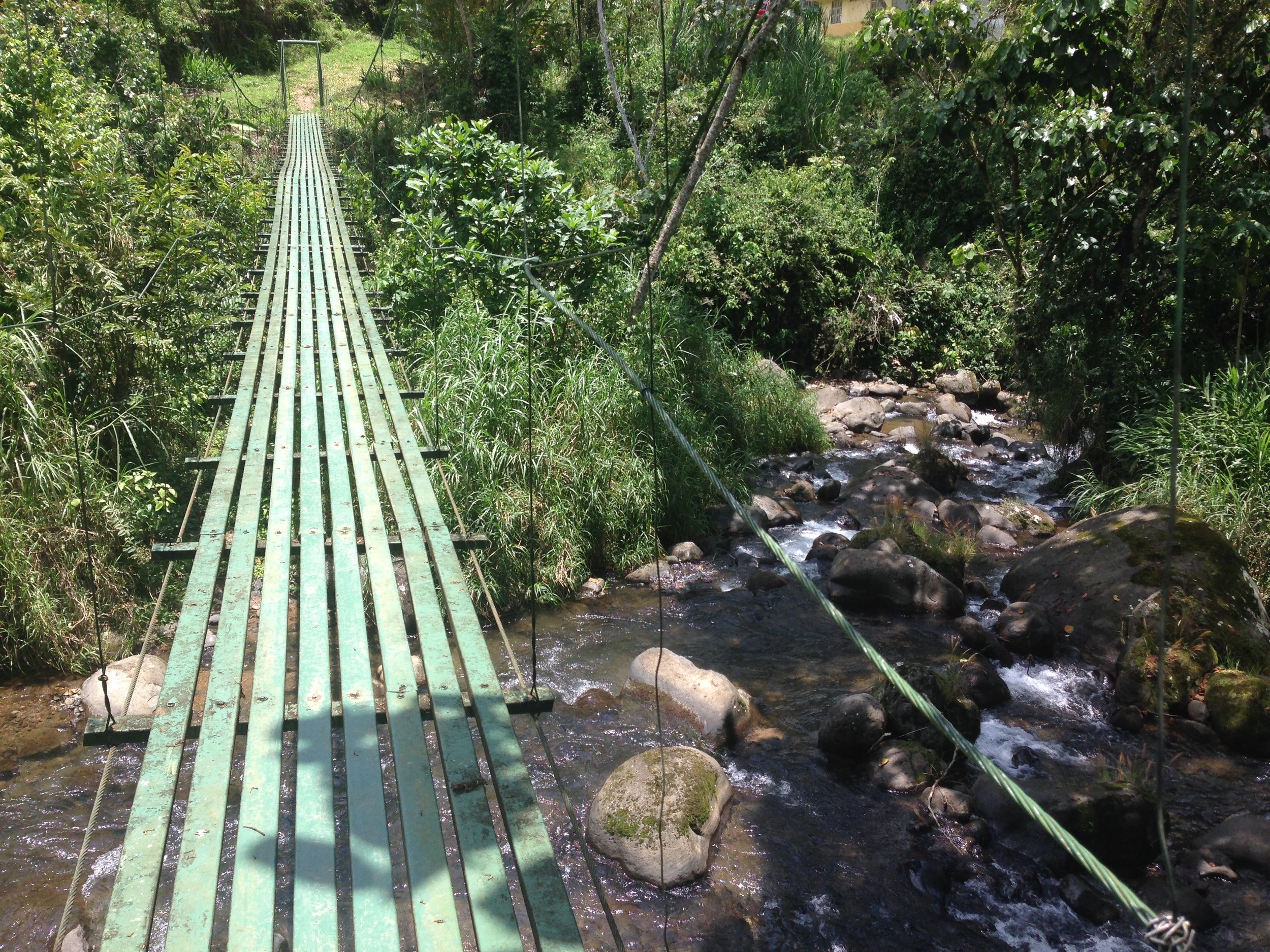
Cross The Bridge And You're On The Campgrounds!